- Start/Finish at the Cerro Coso College gym, 3000 S. College Heights Blvd. Ridgecrest
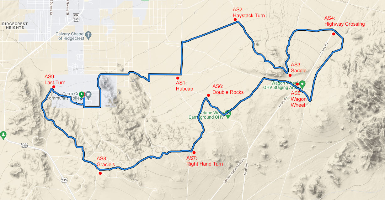
- Loop course over rolling desert terrain on jeep roads, single track trails, and sandy washes
- Approximately 2660' of elevation gain and loss
- The low point is at 2516' elevation and the high point is 3705'.
- The course will be marked with chalk, ribbons and signs.

Click on the map to view an interactive course map and download a .gpx file.

Aid Stations
- Nine great aid stations support the 50K runners
- Aid stations will be stocked with water, electrolyte drink, cola, cookies, bananas, pretzels, Vaseline, S-caps.
- There will be no Ibuprofen at the aid stations.
- Crew access is available at Wagon Wheel Crossing (16.2 miles).
- Remote communications provided by Sierra Amateur Radio Club.
High Desert Ultra Aid Stations
| # |
Name |
Miles from Start |
| 1 | Hubcap | 4.7 |
| 2 | Haystack Turn | 7.7 |
| 3 | Saddle | 10.2 |
| 4 | Highway Crossing | 12.8 |
| 5 | Wagon Wheel | 16.2 |
| 6 | Double Rocks | 19.8 |
| 7 | Right Hand Turn | 21.7 |
| 8 | Gracie's | 24.8 |
| 9 | Last Turn | 28.5 |
Cutoff Time
There will be a 2:30 p.m. cut off time at AS8: Gracie's, and a cutoff time of 4 p.m. at the finish.
Crew Access
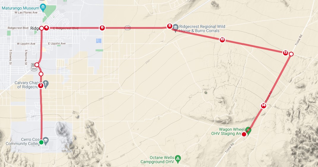
Crew access is available at AS5: Wagon Wheel. This aid station can be reached on paved roads.
- From the race start at the college, backtrack down the hill on College Heights Blvd. and turn right onto S. China Lake Blvd.
- At the intersection of China Lake Blvd. and Ridgecrest Blvd., turn right and head east on Ridgecrest Blvd./Highway 178.
- In about 4.1 miles, turn right onto Randsburg Wash Rd. Just after the turn, you will pass the BLM Wild Horse and Burro Facility on your right.
- In another 4 miles, turn right onto Trona Rd. You will be heading southwest.
- In another 3.1 miles (about 11.2 miles total), the Wagon Wheel aid station will be on your right.

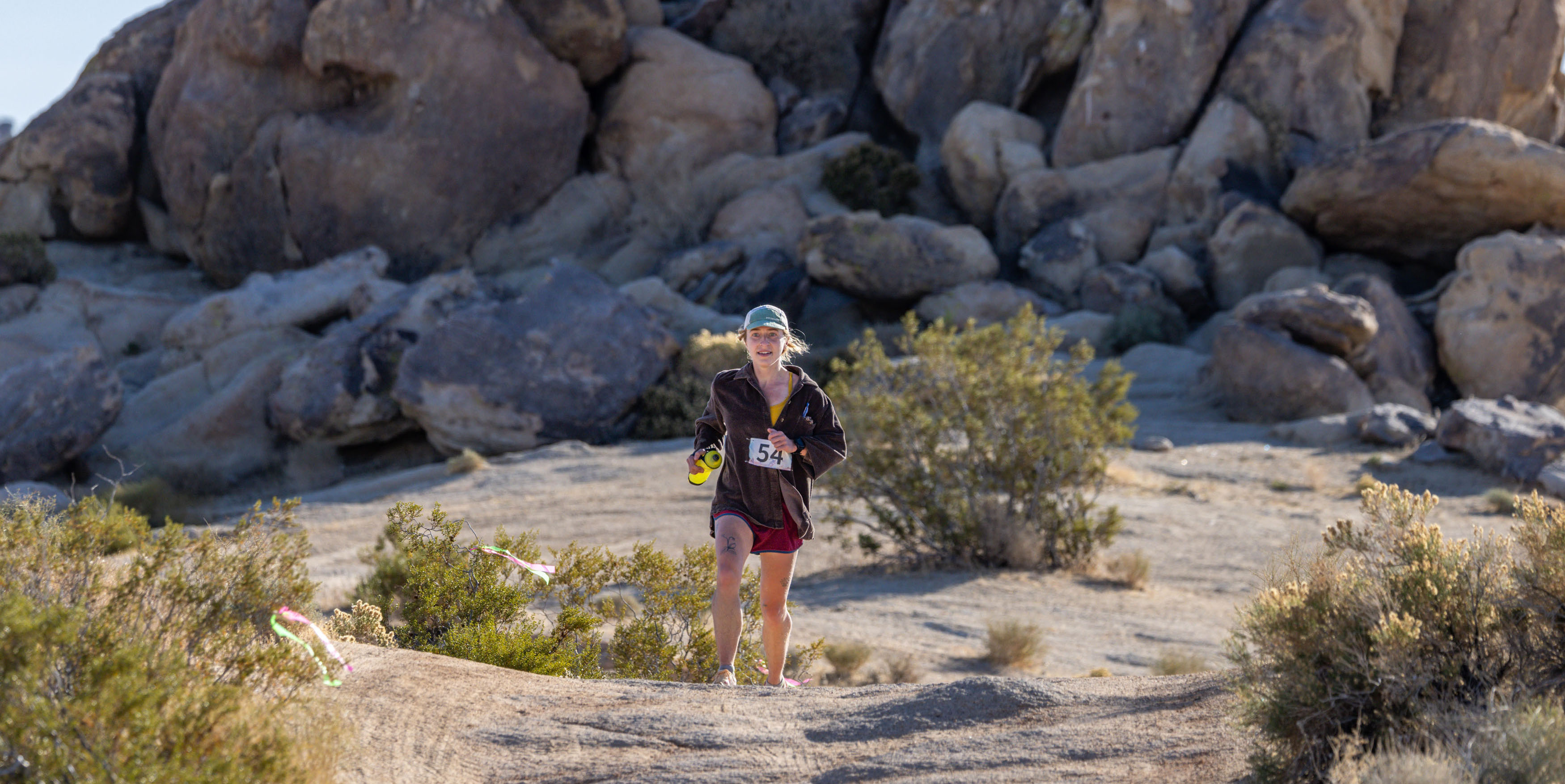
Title photo credit: David Turnbaugh. Used with express permission.


