Hilltop Run
Hilltop Run starts and finishes at the top of the ridge south of the College. The clockwise loop is about 4.0 miles long, and offers some great views. To get to the start, follow College Heighs Blvd out past the college onto the dirt road, signed RC10, and head up to the saddle at the top. There is room to park here. The road is a little bumpy, but you can get there without 4WD.
The green buttons will take you to a Course page on Garmin Connect, or a Route on Strava or MapMyRun. You can review the route navigation instructions here.
Course Description
Begin at the RC10 sign heading south from the saddle. At the first intersection, go left onto RC15 and head up toward Rocky Top Ranch. Go right to avoid the driveway to that property. Then keep left at a Y to head southeast. Continue following RC15. At .85 miles, RC20 joins in from the southwest. Continue east. The signs change to RC20.
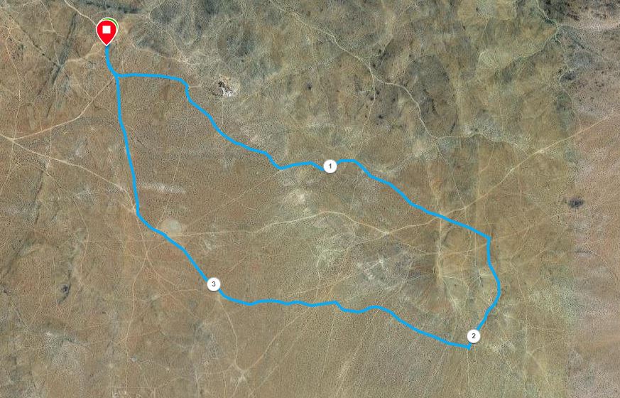
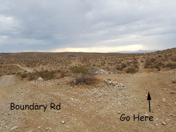
At 1.45 miles, reach Boundary Road, and the first high point. Rather than continuing east on Boundary Road, look for a trail heading across the hill, to the right of the road.
Follow this trail for about .2 miles, straight across the hillside. Then turn right, and proceed up to a ridgetop. Enjoy the view, and then head down the other side. Stay in the wash, until a right turn at about 2 miles.
Now you are on a well-traveled road, heading basically west. When there are crossing roads or trails, stay on the most obvious route. Pass south of a recently constructed memorial, and then rejoin Boundary Road at BLM-signed "Prospector's Campsite". This place is also locally known as "Gracie's Mansion", the site of an old prospector's cabin, and is the location of our High Desert Ultra Aid Station #8.
Continue northwest for a short distance on Boundary Rd, then branch right onto RC10. From here, go straight back to the start/finish.