Lone Ridge Trainer
Course Developer: Tony Scanlan
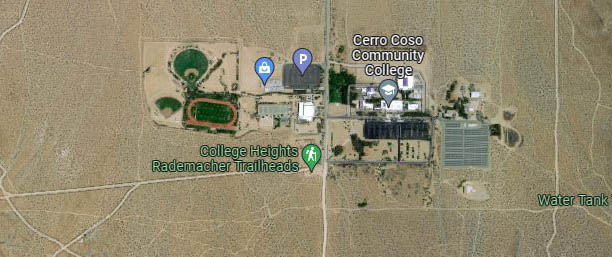
Hearing there might be more cross-country/track participants this year, it seemed appropriate to add a course that has a fast and familiar feel...but not too cushy! This 3.8-mile course runs between the College and Upper Lone Ridge trailheads and has a bit over 300 ft of elevation gain. It is an out-and-back route with a loop at the turnaround (a.k.a. 'lollipop'). Much of it is probably well-known to the local trail veterans, but some of the less-traveled segments may not be. This route begins at the College Trailhead, at the end of the pavement on College Heights Blvd.

The green buttons will take you to a Course page on Garmin Connect, or a Route on Strava or MapMyRun. If you need a .gpx file, you will be able to download that from any of these route pages. You can review the route navigation instructions here.
Course Description
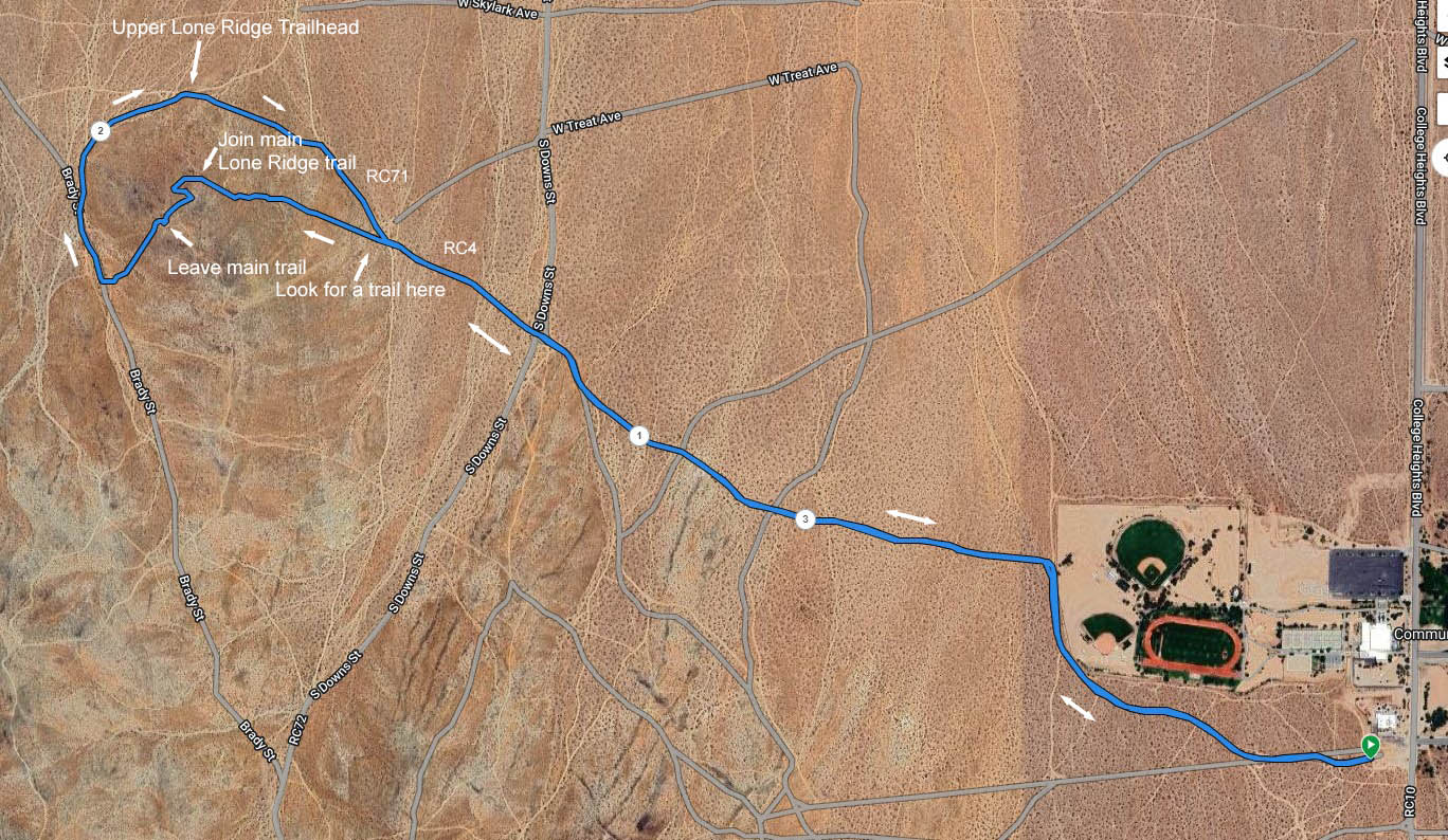
Start at the College trailhead dirt parking area, and look for the trail entrance along the west fence. This is the start/finish point. The course begins by heading generally west for about 200 yards, then splits off to the right, going through the log fencing/rails and onto a trail that meanders northwest. Continue to where the trail meets a dirt road near the corner of the college fence (about 0.4 miles), then turn right on that road to head north briefly. At about 0.5 miles, turn left onto a trail bearing approximately northwest toward Lone Ridge.
At close to 1.1 miles, the trail exits out onto a dirt road (RC4), where you will turn right to head briefly north. Stay on RC4 as it curves left and directs you northwest again. Cross the dirt extension of Downs St. at about 1.17 miles, then continue northwest on RC4. At about 1.35 miles, the course will run into RC71, a road at the base of the Lone Ridge hill.
Look across the road near the log fencing for an entry point to a less-traveled use-trail (it will be marked). Cross the road and go around that fencing to get on the trail. Follow it as it slopes up the north side of Lone Ridge to where it joins the popular Upper Lone Ridge trail at about 1.6 miles. Continue *UPHILL* on the Lone Ridge trail for about 0.1 miles, as it switchbacks to the left, then back to the right. Then when the trail starts to curve back to the left, look for markings on the right where you will hop off the trail to follow another use-trail down the hill on the west side (sorry, no summit!). At the bottom, the trail exits onto a dirt road (Brady St.) at about 1.8 miles.
Take a right here to head downhill (north), then at about 1.9 miles, veer right off Brady toward the stone pile and "Closed Route" marker. Continue on the course as it hugs the north base of the hill and reaches the Upper Lone Ridge trailhead at about 2.1 miles. A few steps further, veer right to stay on RC22 to continue approximately southeast along the base of Lone Ridge. At about 2.28 miles, the course joins RC71 for a sandy bit, then at about 2.4 miles, turn left through the log railing onto RC4. This closes the turnaround loop, leaving only the final 1.35-mile backtrack to the start.
The backtrack: Head southeast on RC4, cross RC73, then cross Downs St. again at 2.6 miles. At about 2.7 miles, take the left turn off RC4 through the log rails and onto the trail there (don't miss it!). At 3.3 miles, turn right at the college fence, then at 3.4 miles turn left through the log rails to take that trail. Continue to the finish at the College trailhead parking, and reward yourself with a cold beverage. Well done!
