Discover the Cholla Trailhead
Course Developer: Jenny McLaughlin
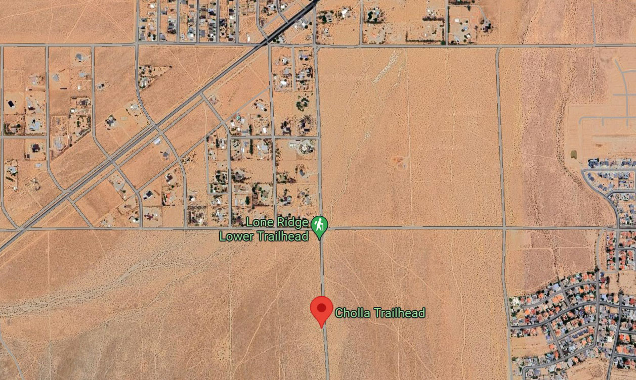
Our first route starts at the Cholla Trailhead, on the west side of South Downs, south of where Downs crosses China Lake Blvd. The trailhead is about 1/4 mile south of Kendall. If the parking lot is full, you can park either at the Lone Ridge Lower Trailhead near Kendall, or further south in one of the pullouts on the next dirt road that crosses Downs (RC69).

The green buttons will take you to a Course page on Garmin Connect, or a Route on Strava or MapMyRun. If you need a .gpx file, you will be able to download that from any of these route pages. You can review the route navigation instructions here.
Course Description
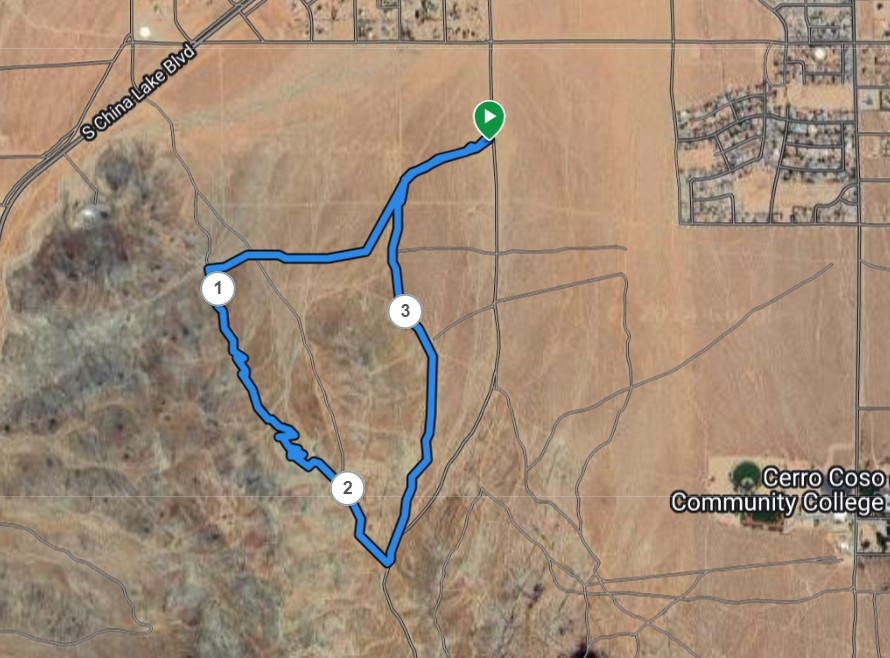
This course is about 3.6 miles in length with about 500 feet of elevation gain. At Cholla Trailhead, look for the trail at a gap in the fence, on the west side of the parking lot. Head southwest on the Cholla Trail. In about 0.25 miles veer left/uphill on the main Lone Ridge trail. You will soon cross RC69.
About 0.5 miles from the start, turn right onto a prominent east-west bike trail. This eventually broadens and is labeled as RC66. It will head west and gently uphill, crossing the well-traveled Brady Road extension at about 0.8 miles.
Keep your eyes open for single tracks crossing your road. At about .95 miles, turn left onto the single track trail. Follow this uphill for about 0.1 mile to intersect the single track trail known as "Brady Loop" or "Eureka". Turn left onto that trail.
Follow this trail for about 0.75 miles until you reach a trail sign indicating "Pineapple Trail" is to the left. This point is about 1.8 miles from the start. Exit to the left, for a few yards. Where this lovely trail intersects a gnarly road, head left/downhill on that road for a few more yards to reach a relatively smooth road. Turn right onto this smoother road that contours the hill until you reach another gnarly road. Turn left onto that gnarly road and go downhill to nice, smooth Brady. You are now at the saddle above Lone Ridge. This point is about 1.95 miles from the start.
Turn right onto Brady and head southeast for about a quarter mile. At about 2.2 miles from the start, Brady intersects the north-south dirt road that is the extension of Downs. Turn left and head downhill for about 1/10 of a mile to reach a 3-way fork in the road.
Take the middle fork, marked RC71, leaving Downs. Continue north, on the east side of Lone Ridge. Then at about 3 miles, take the right fork to continue heading north. Follow this until it ends at T-junction with RC69 at about 3.25 miles from the start.
Locate the rock-lined trail that continues on down the slope. The start of that trail is offset to the right a little bit. Follow the trail until it merges with the Lone Ridge trail in a few yards. Continue going downhill to the junction with the Cholla trail at about 3.3 miles from the start. Turn right onto the Cholla trail, and finish at the Cholla Trailhead.
