Bakatare One Hill
Course Developer: Julie Jensen
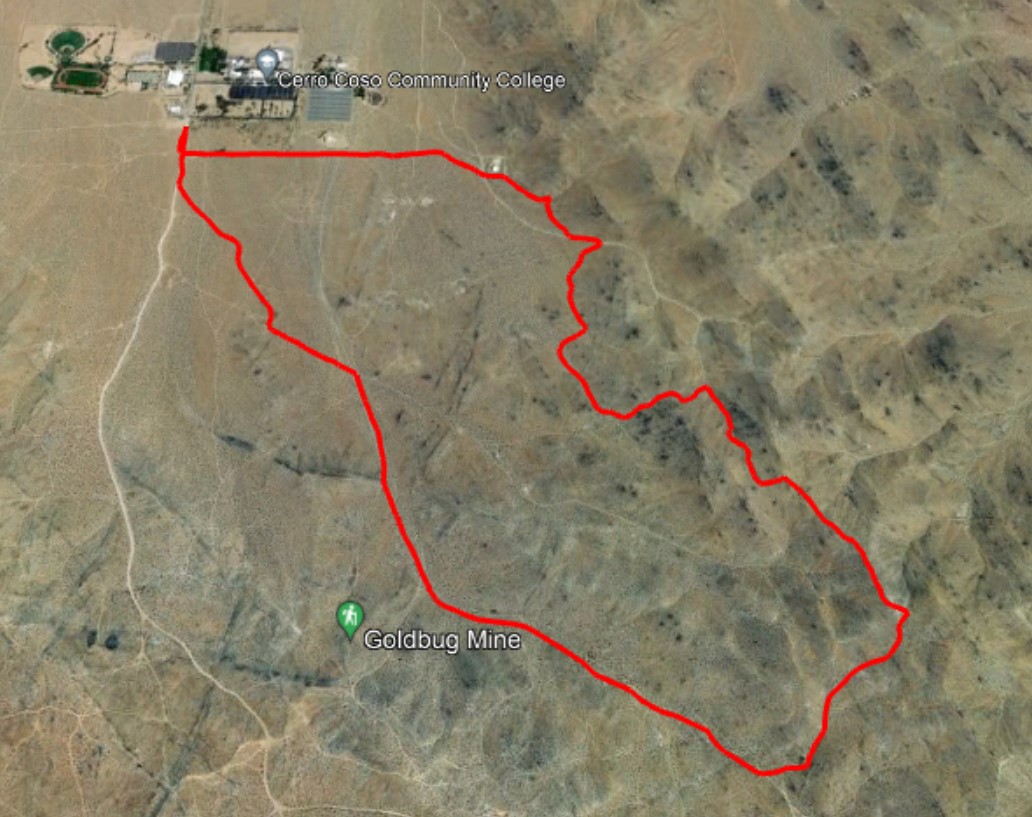
This course was first done as an OTHTC fun run organized by Karin Usko and John Auborn. The name Bakatare is said to mean "fool" in Japanese. This loop course will take you to some less-visited parts of the basin above the college. It is not an easy route, but it will reward you with some great views from the top! The start and finish are at the College Trailhead. Total distance is about 5 miles.

Course Description
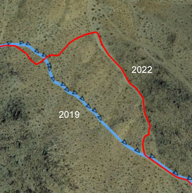
This course description follows the course as run in the 2022 Summer Challenge. One part of the original course proved difficult to follow, and the course was adjusted accordingly.
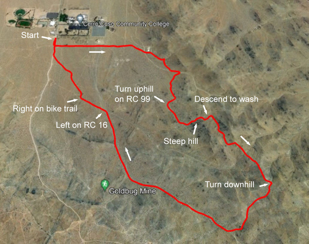
The first part of this course follows the Caballo course. From the parking lot, start on the unpaved College Heights Blvd. heading south. Turn left onto the dirt road that runs along the college fenceline. Continue following the road towards the water tank. Skirt the south side of the fenced tank and turn right onto the single track at the trailhead sign. Cut back sharply to the right where another single track joins. Continue on this trail to a join a prominent road, and continue uphill. Turn right at RC97 (about 1.1 miles from the start) then left at the first dirt road going uphill. At about 1.35 miles, turn right on a less-traveled road. Watch for a junction at about 1.43 miles, where you will turn uphill. Here is where we leave the Caballo course.

Continue uphill on RC99. At an area where several roads converge, bend left and climb the steep, rocky climb. At the top, take the single track to the right. This path, followed in the 2019 Bakatare, has become difficult to follow. The 2022 route descends to the jeep road coming up the wash below and follows it up. As an alternate route, you could make your way cross-country, contouring over to the jeep road. Aim to join the road just above a steeper section, where the angle eases. By contouring, you will not have a well-defined trail, but you will avoid the steep ascent and save about .1 mile distance.

Turn right and follow the bend to the left. At the top, turn left and climb the next hill. Just over the top, take the single track to the right and enjoy a slight downhill finally. At the fork, stay left on the single track. It will eventually widen. You have finished the climbing. At a flatter area where several roads cross, turn right and go downhill.
Bear right onto RC27 to continue going downhill. You will be on this road for awhile. Just past the RC16 sign, turn left. At the top of the rise, turn right and follow the single track through the rocks. Stay on this path all the way to College Heights Blvd. Join College Heights and head to the finish.
The green buttons will take you to a Course page on Garmin Connect, or a Route on Strava or MapMyRun.